Kerman Briefly
Kerman the capital of Kerman province located in an altitude of 1,860m above sea level and 1,602 km to the south of Tehran, is a wonderful place. Unless one travels to Kerman by air, it seems a very long way from any other center of importance, no matter whether one approaches it from the northwest, the southwest or the southeast.
Kerman and Marco Polo
The southern arm of the Aryan trade roads ran through Kerman province and city. A branch would also have passed through the southern town of Jiroft. Marco Polo passed through the kingdom of Kerman in 1271 CE after visiting Yazd. Chapter 17 of The book of Ser Marco Polo, the Venetian, Vol
Climate
The city's many districts are surrounded by mountains which bring variety to Kerman's year-round weather pattern, thus the northern part of the city is located in an arid desert area, while the highland of the southern part of the city enjoys a more moderate climate. The mean elevation of the city is about 1755 m above sea level
Geography
Kerman is located on a high margin of Kavir-e Lut (Lut Desert) in the central south of Iran. The city is surrounded by mountains. Kerman is also located along the Saheb Al Zman mountain. The city is 1,755 m (5,758 ft) above sea level that makes it the third capital city(of a province) in Iran with the highest Elevation
Culture
Kerman has an abundance of architectural relics of antiquity. Kerman is among several cites in Iran with a strong cultural heritage, which is expressed in the local accent, poetry, local music, handicrafts and customs that Kerman has introduced to the world of culture. The only anthropology Iran museum of Zoroastrians in the world, which showcases the ancient history of Zoroastrians, is in Kerman’s Fire Temple
Economy
The economy of Kerman is mostly based on farming, notably nut farming and also mining. Sarchashmeh Copper mine is the second-biggest copper mine in the world after the one located in Chile. Pistachio is an important source of economy in Kerman, with Kerman Province being the biggest producer of pistachio in Iran and all over the world
Traveling and Staying in the Province
All cites and towns of the province are connected to each other by a modern transport system including roads as well as the railroad. The national railroad system trespasses this province to connect the city of Kerman to the national capital Tehran as well as other important cities such as Esfahan and the Largest port on the Persian Gulf, Bandar Abbas
Protected Zones, Kerman
Due to certain factors such as its geographical location, environment and other natural aspects of the province, a variety of wildlife species can be found in the mountainous regions and plains of this vicinity; thus bringing forth protected areas here, and a prohibition as to hunting by the Department of the Environment
Kerman's Zoroastrian Population
Kerman together with Yazd and Pars (Persia) became part of the Zoroastrian group of nations after the close of the Avestan canon, that is, the time when no further additions to the Avesta were made. Kerman could very well have received Zoroastrianism via Khorasan and Siestan rather than via Pars and Yazd. After the Islamic Arab invasion of Iran, Kerman, and Yazd became the two provinces that continued to maintain significant numbers of Zoroastrians and therefore Zoroastrian neighborhoods
Tourist Attractions
The Ganjali Khan Complex, Vakil Bath of Kerman, Jabalieh Dome(the sole stone structure in Kerman), The Bam Citadle or Arg-e Bam (the largest adobe building in the world),Rayen Citadle or Arge-e-Rayen (a castle demonstrating Persian culture and antiquity), Shazdeh Mahan Garden(A green paradise at the heart of desert), Fath Abad Garden, Simak Waterfalls, Yakhdan Moayedi (Moayedi Ice-house ), Makhrage salt lake, Darvish Khan's Stone Garden ( a mysterious garden), Lut Desert, and Shahdad Kaluts
Ganjali Khan Complex
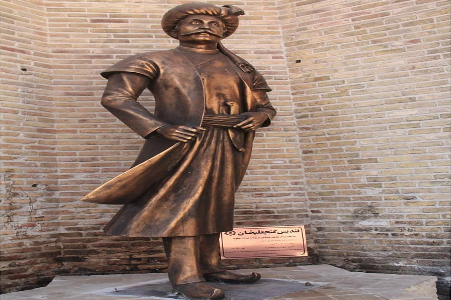
Ganjali Khan Complex is a Safavid-era building complex, located in the old center of the city of Kerman, Iran. The complex is composed of a school, a square, a caravanserai, a bathhouse, an Ab Anbar (water reservoir), a mint, a mosque, and a bazaar. This complex was built by Ganjali Khan who governed Kerman, and in Isfahani style of architecture. There are a number of poem inscriptions laid inside the complex that decoding of the last hemistich smartly indicates the exact date when these places have been built
Ganjali Khan Square
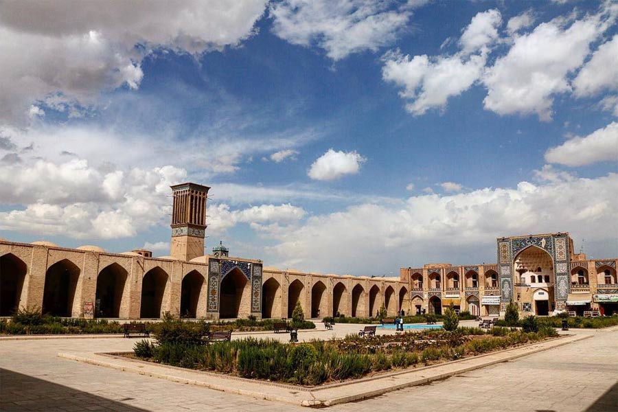
In ancient Iran, the squares of the cities were established near the governorships and were places for gatherings and ceremonies. The architecture is Similar to Naqsh-e Jahan Square in Isfahan and Mir Chakhmagh Square in Yazd is surrounded by urban elements such as bazaars, Caravanserais and schools
Ganjali Khan Bathhouse
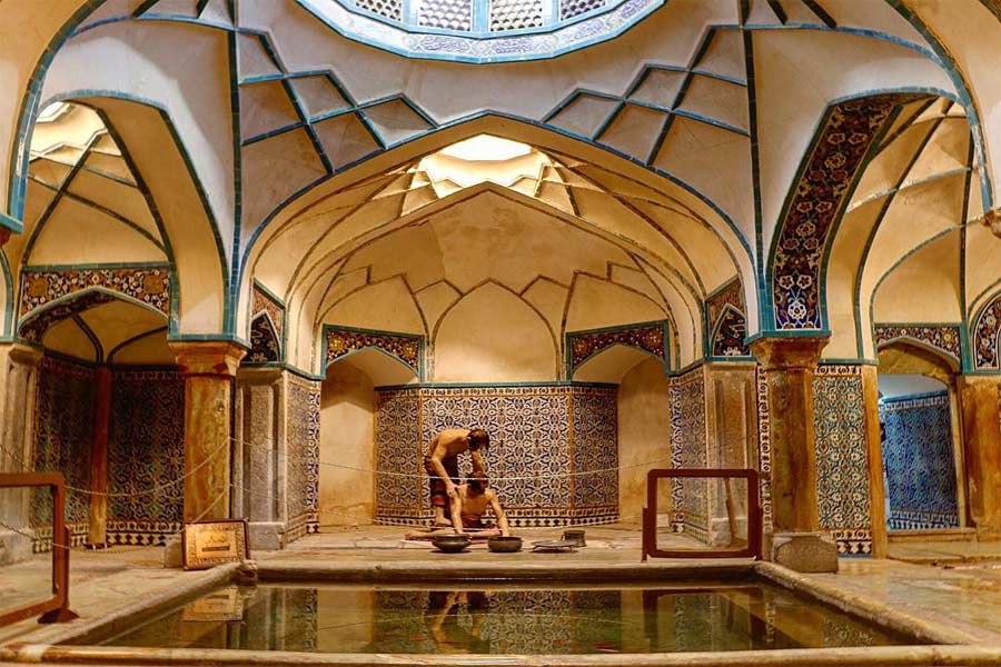
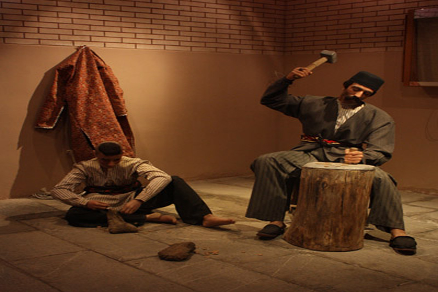
The entrance of the building is painted with ornaments of the Safavid era. It is composed of a disrobing room, cold room, and hot room, all covered with domes carried on squinches. It is composed of a disrobing room, cold room, and hot room, all covered with domes carried on squinches. The Ganjali Baths are unique works of architecture decorated with exquisite tile works, paintings, stuccos, and arches. The bathhouse was converted into an anthropological museum in 1971. In the closet section and main yard of the bath, there are many lifelike statues. These statues were designed at Tehran University's faculty of fine arts in 1973 and then transferred to this museum
Ganjali Khan Bazaar
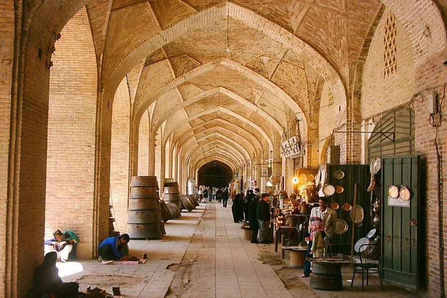
The bazaar is located in the southern part of Ganjali Square. Inside, the bazaar is decorated with exquisite plasterwork and wall paintings and although they are 400 years old, they are still well-preserved. The bazaar is 93 meters long and is connected to Ganjali square through 16 Iwans and vaults
Ganjali Khan Caravanserai and Mosque
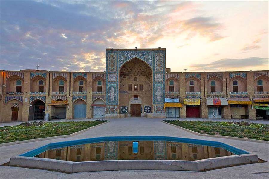
The plan of the caravanserai is based on the four-Iwan typology, with double-story halls centered on tall Iwans enveloping four sides of an open courtyard. There is an octagonal fountain at the center of the courtyard which is chamfered at the corners. The caravanserai measures thirty-one and a half by twenty-three meters. It has a small domed mosque at one corner that measures five and a half by five meters
Ganjali Khan Mint
The mint’s construction started in 1598 and ended in 1625. The interior decorations consist of ochre plasterwork and brickwork. The building has a tall dome crowned by a cupola to admit light and vent air. The mint was converted into a numismatics museum in 1970. The museum displays coins from different periods such as Parthian, Sassanid, Safavid and Afsharid periods
Shazdeh Mahan Garden
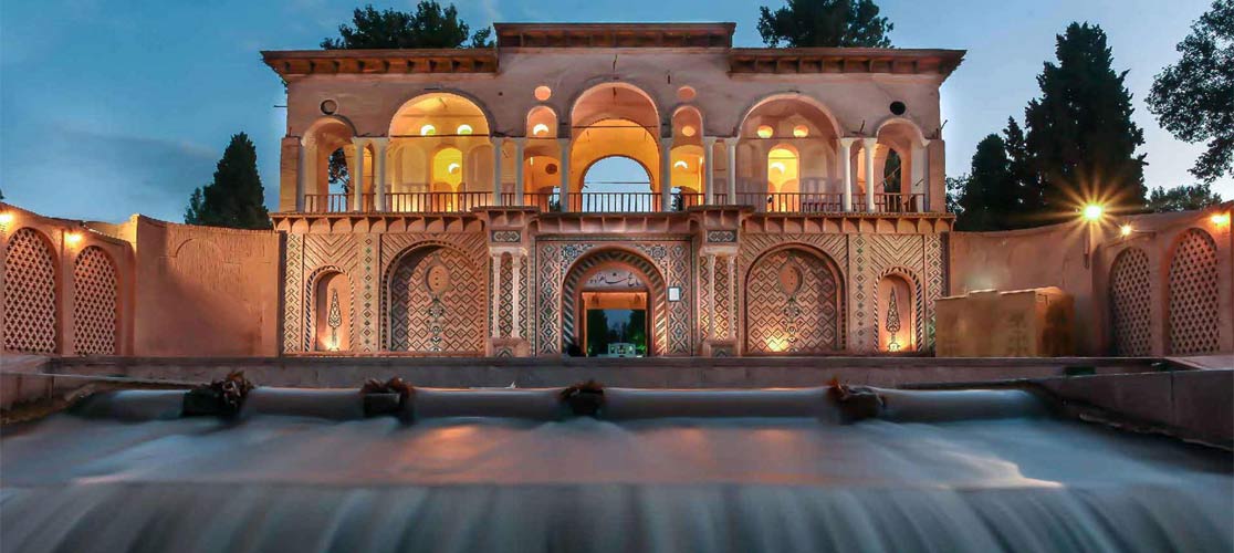
The city of Mahan is located in the southeast of Kerman. At a distance of 6 km. undefined from the south of Mahan, is a beautiful and large garden with a spectacular structure on the premises. The same is called 'Shazdeh Garden' (Shazdeh Bagh). The structure is relative to the Qajar era. There are various pools constructed in the garden that is sheltered with fine trees. In the year 1991, the premises were completely renovated because of the commemoration ceremony of Khaju Kermani. A traditional guest house has been constructed in the city center for the use of tourists and visitors. The garden is a fine example of Persian gardens that take advantage of suitable natural climate. Water fountains can be seen over the land flowing from the upper ends toward lower ends on a water cascade style at Shazdeh Garden. These fountains look very beautiful and have been provided impetus by the natural incline of the place. The clever use of the natural climate of the land can be seen in this garden which is the primary aspect of every Persian garden. House façade at the entrance of the garden is like a linear structure at the beginning of the garden and the building has two floors. Undefined The upper floor has rooms for living and catering. Apart from the entrance structure, this garden includes a kingly mansion and bathroom. The kingly mansion is turned into a restaurant at the moment and is run by a private sector. Various fruit trees can be seen in this garden and the ponds and fountains have made an elegant waterfront. Undefined In 2005 experts of the Research Center for Historical Sites and Structures were preparing documents to register Shazdeh Garden, amongst other gardens, on the UNESCO World Heritage List and the Garden was finally inscribed in June of 2011
Fath Abad Garden
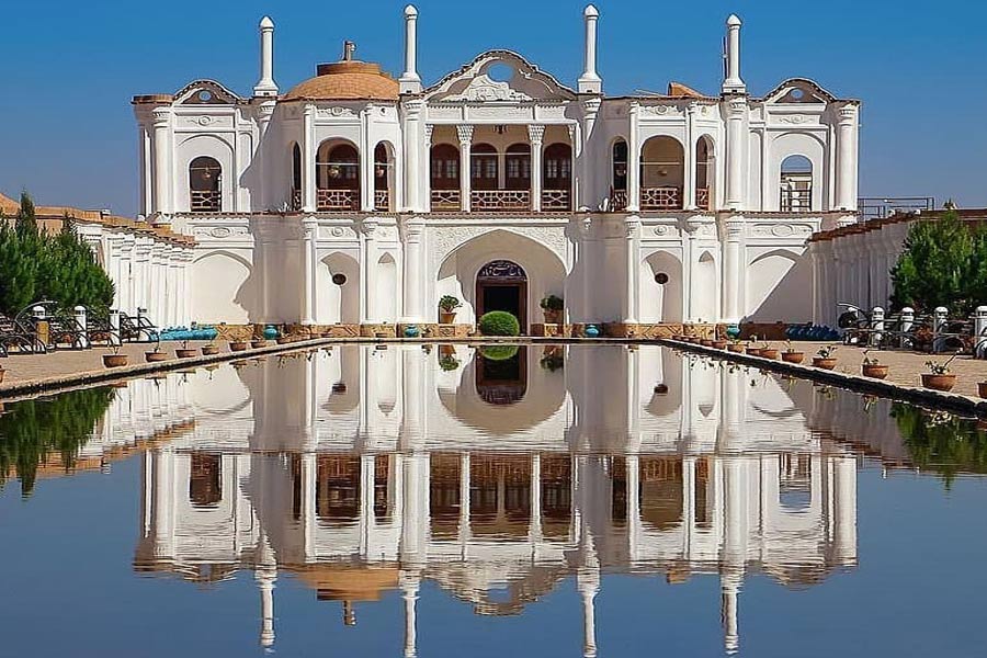
Fath Abad Garden is one of the most sophisticated and most visited places as an Iran tourism attraction. Kerman has about 7,000 valuable historical attractions, including 700 of which are listed on the national monuments list. Fath Abad Garden, belongs to the Qajar period and is located 25 km from Kerman city and located in the Ekhtiar Abad village. Fath Abad Garden is one of the most valuable Iran gardens. As you know, the Iranian garden model is one of the achievements of Iran in international societies and Iran is full of beautiful gardens that can be seen in the city. Iranian gardens plan can be seen in the Iranian traditional carpet design. Four gardens of Cyrus and miniaturists that water flows from one central pool to the four sides are examples of ancient Iranian gardens. Fath Abad Garden, the pond in front of the mansion has the same characteristics and the role of water in the formation of the garden has been very effective so that the lack of it had led to the destruction of the garden and its mansion before its rebuilding. This Beautiful garden was built by one of the rulers of Kerman, in 1255 solar year (SH). This historic garden was one of the oldest gardens in Iran and, which was gradually forgotten and became ruinous. Fath Abad Garden architecture is a combination of European and Iranian architecture and there are various gardens and agricultural lands around it. The Fath Abad Garden is a symbol of the paradise that Hassan Sabbah promised to his followers in Alamut Castle
Jabalieh Dome
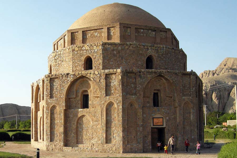
Almost all the tourists will visit the Jabalieh dome as their main destination in Kerman. The exact date of construction is unknown. Historians speculate that this dome built in the late Sasanians era or the early Islamic period. A group of experts says that this dome was one of the Zoroastrians tombs and is related to the late Sassanid period. The Jabalieh dome is also known Gabrie. So some historians say that this building dates back to the pre-Islamic era. This valuable historical monument in the province of Kerman built octagonally. The base material is stones used in its construction. This octagonal building has eight doors that are located on each side. For the reason of the strength of the building, they have already covered seven doors with stones and kept only one door open. The roof of this dome made of bricks and the inside of the building made of beautiful stucco. But unfortunately, most of these stuccos destroyed. The materials used in the walls are with a rubble trench foundation and gypsum mortar from the outside and lime from the inside. There are many trees around this building that have become a jungle park. People can picnic in this park except to visit this building. The building has recently become a museum. Within this historical dome, there is a valuable inscription called the inscription of the mosque Abder Ashkan. Another valuable thing of the Kerman Jabalieh dome is a small tombstone with a size of 26 × 22 and has two important parts. One of the sections is margins, and the other one is the middle text. These writings are the Qur'an's Ayah. In this dome, more than 120 pieces of stone carvings discovered that relate to different historical periods
Lut Desert
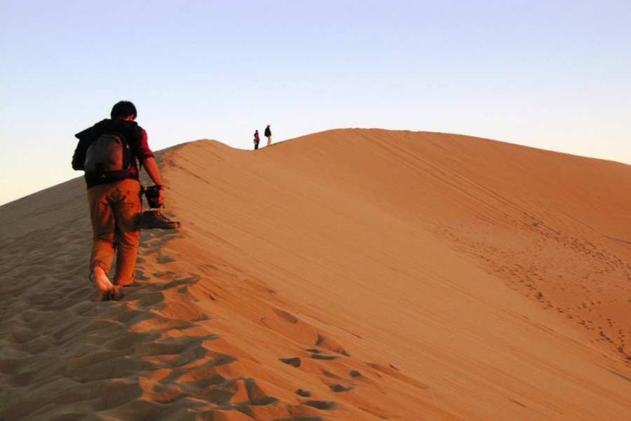
Lut Desert, also known as the Loot Desert, is a large salt desert in Kerman and Sistan of Iran and is the world's 25th largest desert. Lut Desert is one of the world's driest and hottest places. It was inscribed to the UNESCO WORLD HERITAGE SITES list on July 17, 2016. The Lut Desert protects a globally recognized iconic hot desert landscape, one of the hottest places on earth. It is renowned for its spectacular series of landforms namely the yardangs (massive corrugated ridges) in the west of the property and the sand sea in the east. The property Lut Desert is in the southeast of Iran. It is an arid continental subtropical area notable for a rich variety of spectacular desert landforms. At 2,278,015 ha the area is large and is surrounded by a buffer zone of 1,794,134 ha which varies in width between 10 and 30 kms. In the Persian language “Lut” refers to bare land without water and devoid of vegetation. The Lut Desert is situated in an interior basin surrounded by mountains, so it is in a rain shadow and, coupled with high temperatures, the climate is hyper-arid. The region often experiences Earth’s highest land surface temperatures: a temperature of 70.7C has been recorded within the property. The largest incoming river, the Rud-e Shur, drains a catchment to the north of the area. It is perennial but highly saline by the time it enters the core zone; so its banks are devoid of riparian vegetation and its channel is lined with salt crystals. The region has been described in the past as a place of ‘no life’ and information on the biological resources in this area is limited. Nevertheless, the nomination dossier documents the area’s known flora and fauna including an interesting adapted insect fauna and other species which have made their home in this extreme environment. Within the area, only the western edge includes settlements (there being 28 villages, the largest with just over 700 people). In the buffer zone, there are 15 villages and Shahdad town with a population of nearly 6,000. The region has evidence for habitation going back 7,000 years, however, this has always been around the periphery of the area because the aridity of the core zone rendered most of it uninhabitable
Bam Castle
In the early centuries, Bam was the second most important city of Kerman and was an important Centre for trade with the provinces of Sistan and Khorasan. Bam is located 220 km southeast of Kerman, it stands at an altitude of 1062 m. Bam enjoys the benefits of two very extreme altitudes. There is the mountainous area, which is provided by a continuation of the central mountain ranges from Iran. Cities do not die after being abandoned .they are alive even when the earthquake ruins them. When on December 26, 2003; an earthquake killed almost a generation of the bam it was thought that the 2000-years-old history of the man had also buried under the debris. Nevertheless, the fact is that the world largest complex made of sun-dried bricks are still alive and it is one of the best hosts for the tourists. Arg-e Bam (Bam citadel) with an area of 20 hectares and 492 hectares cultural landscape is located on the eastern north of Bam and at the foot of an enormous rock; it was once the old city of Bam. The old Bam consists of 4 parts and 38 watchtowers. The main materials of the castle were adobe, clay, and chaff. It is by UNESCO as part of the WORLD HERITAGE SITE “Bam and its cultural landscape”. This enormous citadel on the Silk Road was built before 500 BC and remained in use until 1850 AD. It is not known for certain why it was then abandoned. The 2003 Earthquake in Bam destroyed more than 80 percent of the citadel. Bam Castle is larger than nearby Rayen Castle, the area of Bam Citadel is approximately 180,000 square meters (44 acres), and it is surrounded by gigantic walls 6–7 meters (20–23 ft) high and 1,815 metres (5,955 ft) long. The citadel features two of the “stay-awake towers” for which Bam is famed – there are as many as 67 such towers scattered across the ancient city of Bam. The planning and architecture of the citadel are thought out from different points of view. From the present form of the citadel, one can see that the planner(s) had foreseen the entire final form of the building and city from the first steps in the planning process. During each phase of building development, the already-built part enjoyed a complete figure, and each additional part could be “sewn” into the existing section seamlessly. The Citadel is situated in the center of the fortress-city, on the point with the widest view for security

Rayen Castle
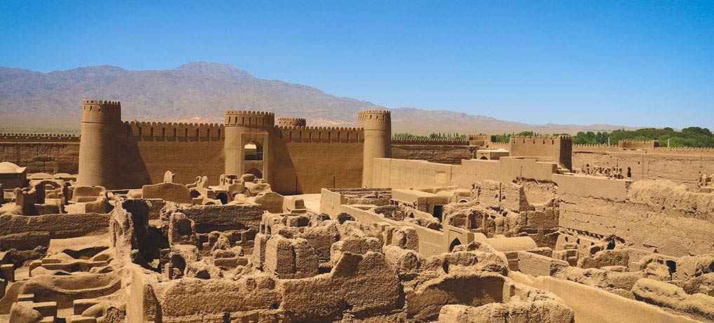
Rayen castle or Arg-e Rayen is an adobe castle in Rayen town in Kerman, you can visit the medieval mud-brick city of Rayen is similar to the Arg-e Bam. Rayen displays all the architectural elements of a deserted citadel. It appears extremely well preserved, considering the numerous natural disasters that have been destroying similar structures nearby, and it is one of the most interesting historical sites in Iran. The fortress at Rayen is similar in outlook and construction to the fortress at Bam, while been younger in age. It is thought to be a Sassanian era (224 CE – 649 CE) fortress. Like Bam, Rayen fortress was in use until about 150 years ago. Rayen Citadel is a historical site situated in the south-west of Rayen city and is considered the biggest earthen structure of Kerman province after Bam Citadel which was destroyed in an earthquake in 2003. The monument dates back to the Sassanid era and covers a 20,000-square-meter area, remaining a symbol of the residential fortresses during ancient times. Just like other fortresses, it consists of the public quarter and the aristocratic zone. The essential sectors such as Zoorkhaneh (gymnasium for a traditional Persian sport), mosque, and stable can be seen in the citadel. Adobe is the main material used in its construction. Rayen citadelRight now a model of Bam Citadel with a size of 10×10 square meters is being created by one of the famous Kerman sculptors in one of the storehouses of Rayen Citadel. The aristocratic area of the citadel is under restoration and is not yet open to public visits. Two ancient industries practiced in Rayen city, weaponry, and knife-making, are due to be revived thereby establishing workshops in the area of Rayen Citadel. Setting up a traditional tea house near the citadel is one of the other programs for its tourism development. The hotel and restaurant which were built last year have started working and are ready to host tourists. Rayen citadel Natural and historical attractions of Rayen area are not just limited to the ancient citadel. Rayen, located on the foothills of Hezar Mountains and a beautiful waterfall, enjoys a favorable climate in Kerman province. The mountain with a height of 4465 meters is the highest mountain in Kerman province and the forth of Iran. Caraway, which is a famous seed of Kerman province, grows wild in these mountains. Local residents believe that Rayen forces won in wars due to the quality of their handmade weaponry produced by locals. It is believed that Rayen Citadel dates back to the Sassanid era, although what is remained today belongs to the Islamic period constructions, mainly the Safavid era and afterward. Shahzadeh Garden, Shahnematollah VAli Mausoleum, and Arge-e-Rayen all are in one road, Motevalli bashi traditional hotel, placed just at the back of Shahnematollah vali Mausoleum, in Mahan (30 km from Kerman city) has prepared the opportunity for visitors, to stay there, and make it easy for visitors to visit these 3 main attractions in Kerman
